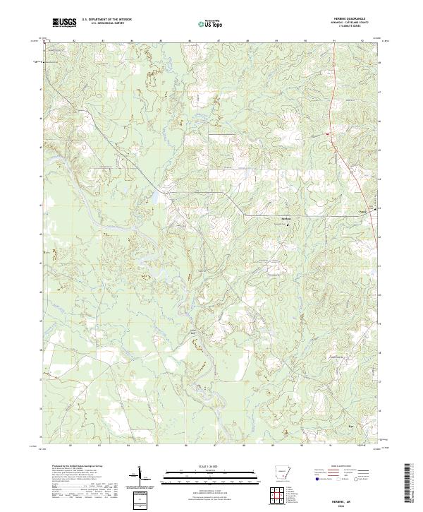
2024 Map of Herbine
USGS Topo · Published 2024About this map
The Saline River winds through the heart of this Cleveland County landscape, creating a complex network of wetlands and tributaries like Sixteenth Creek and Mill Branch. The settlement of Herbine sits centrally, surrounded by family-named landmarks and rural infrastructure including Prosperity Cem and Schultz Lake. To the south, Vince Bluff marks a distinct rise overlooking the river bottomlands, while the community of Rye anchors the southeastern corner. This recent survey illustrates a region defined by its waterway-driven geography, where historical rural roads like Neely Rd and Goggans Rd connect dispersed homesteads. For those studying local history, the map provides precise locations for generational sites such as Macedonia Cem and the small hamlet of Pansy, preserving the layout of these Arkansas communities in the contemporary era.
Find a feature on this map
57 named features on this map. Tap any name to fly to it.
Don’t see what you’re looking for? This feature index may not catch every label — zoom into the map to look around manually.
Map Details
Editions of this 2024 Herbine Map
This is the sole edition of this map. No revisions or reprints were ever made.
Other maps of this area

1935 · Feenyville
USGS Topo · 1:62,500

1953 · Greenwood
USGS Topo · 1:250,000

1953 · El Dorado
USGS Topo · 1:250,000

1956 · Greenwood
USGS Topo · 1:250,000

1957 · El Dorado
USGS Topo · 1:250,000

1958 · El Dorado
USGS Topo · 1:250,000

1960 · El Dorado
USGS Topo · 1:250,000
1970 · Calmer
USGS Topo · 1:24,000

1970 · New Edinburg
USGS Topo · 1:24,000

1970 · Herbine
USGS Topo · 1:24,000