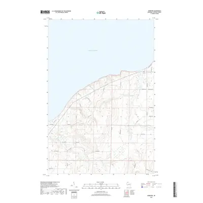
2018 Map of Herbster
USGS Topo · Published 2018About this map
Lake Superior dominates the northern boundary of this coastal survey, where the rugged South Shore drainage system carves through the Bayfield County landscape. The terrain is defined by the parallel courses of the Cranberry River and the Flag River, both of which split into significant branches like the W Fork Cranberry River and the E Fork Flag River before reaching the lake. The road network reflects a history of rural settlement and local industry, with family-named routes such as Arney Rd, Bodeen Rd, and Busche Town Rd connecting the interior to the coast. Near the shoreline, Bark Point Rd and Old School Rd suggest the location of early community centers and access points to the water. The intricate contour lines illustrate the steep drainage ravines common to this region of northern Wisconsin, providing a clear look at the area's physical geography in the early 21st century.
Find a feature on this map
33 named features on this map. Tap any name to fly to it.
Don’t see what you’re looking for? This feature index may not catch every label — zoom into the map to look around manually.
Map Details
Editions of this 2018 Herbster Map
This is the sole edition of this map. No revisions or reprints were ever made.
Other maps of this area

1943 · Port Wing
USGS Topo · 1:48,000

1943 · Iron Lake
USGS Topo · 1:48,000

1944 · Moquah
USGS Topo · 1:48,000

1944 · Cornucopia
USGS Topo · 1:48,000

1946 · Cornucopia
USGS Topo · 1:48,000

1946 · Port Wing
USGS Topo · 1:48,000

1947 · Moquah
USGS Topo · 1:48,000

1947 · Iron Lake
USGS Topo · 1:48,000

1953 · Ashland
USGS Topo · 1:250,000

1958 · Ashland
USGS Topo · 1:250,000