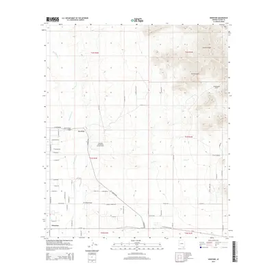
2014 Map of Hereford
USGS Topo · Published 2014About this map
The San Pedro River flows through this corner of Cochise County, anchoring a high-desert landscape defined by broad alluvial basins and the steep rising slopes of the Mule Mountains. Near the historic crossing at the Hereford Road Bridge, the small settlement of Hereford sits west of the river, while the community of Palominas occupies the southern reach along Az-92. The presence of the Thompson International Aviation Airport underscores the region's modern utility, contrasted by the traditional ranching and rural residential patterns along corridors like E Hereford Rd and S Palominas Rd. To the northeast, the terrain becomes increasingly complex as it climbs toward Escabrosa Ridge, where drainage features like Schoolhouse Draw and Spring Cr carve through the foothills. This survey captures a moment of transition where low-density desert living meets the significant topographic barriers of the Arizona borderlands.
Find a feature on this map
60 named features on this map. Tap any name to fly to it.
Don’t see what you’re looking for? This feature index may not catch every label — zoom into the map to look around manually.
Map Details
Editions of this 2014 Hereford Map
This is the sole edition of this map. No revisions or reprints were ever made.
Other maps of this area

1902 · Bisbee
USGS Topo · 1:62,500

1910 · Bisbee
USGS Topo · 1:62,500

1914 · Hereford
USGS Topo · 1:125,000

1915 · Benson
USGS Topo · 1:125,000

1916 · Pearce
USGS Topo · 1:125,000

1916 · Douglas
USGS Topo · 1:125,000

1919 · Douglas
USGS Topo · 1:125,000

1925 · Gleeson
USGS Topo · 1:62,500

1927 · Bisbee
USGS Topo · 1:62,500

1932 · Stark
USGS Topo · 1:62,500