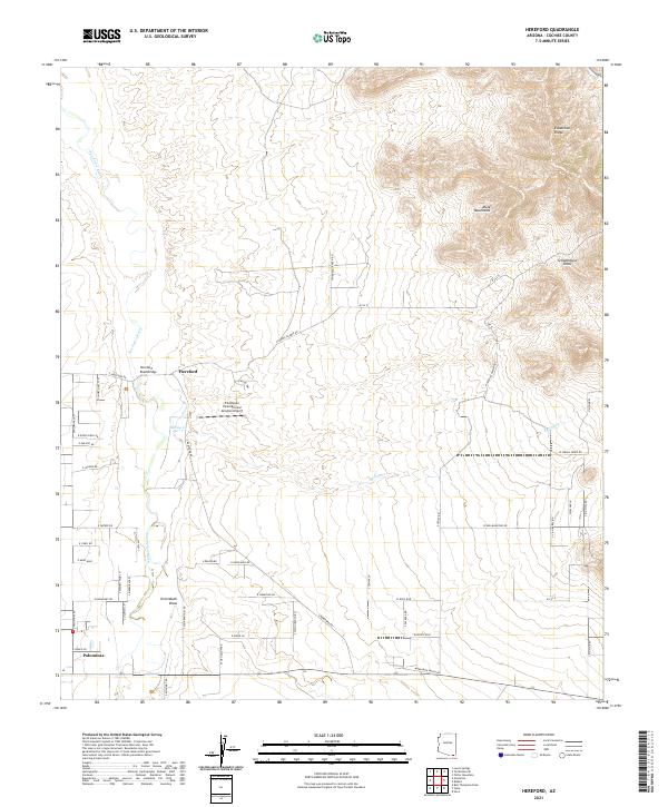
2021 Map of Hereford
USGS Topo · Published 2021About this map
The San Pedro River valley defines this part of Cochise County, flowing northward through a landscape of ranch roads and desert draws. The small community of Hereford sits near the Hereford Road Bridge, serving as a focal point for the surrounding rural developments. To the south, Palominas marks another center of habitation, situated near the intersection of various ranch-named routes like S Paloma Trl and S Ullrich Ln.
Find a feature on this map
60 named features on this map. Tap any name to fly to it.
Don’t see what you’re looking for? This feature index may not catch every label — zoom into the map to look around manually.
Map Details
Editions of this 2021 Hereford Map
This is the sole edition of this map. No revisions or reprints were ever made.
Other maps of this area

1902 · Bisbee
USGS Topo · 1:62,500

1910 · Bisbee
USGS Topo · 1:62,500

1914 · Hereford
USGS Topo · 1:125,000

1915 · Benson
USGS Topo · 1:125,000

1916 · Pearce
USGS Topo · 1:125,000

1916 · Douglas
USGS Topo · 1:125,000

1919 · Douglas
USGS Topo · 1:125,000

1925 · Gleeson
USGS Topo · 1:62,500

1927 · Bisbee
USGS Topo · 1:62,500

1932 · Stark
USGS Topo · 1:62,500