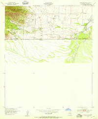
1952 Map of Hereford SW
USGS Topo · Published 1955About this map
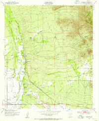
The San Pedro River cuts through the desert landscape of southern Cochise Co, just north of the international boundary between the United States and Mexico. This mid-century survey reveals a ranching economy reliant on carefully managed water resources, as evidenced by a Pumping Sta Substation, multiple pumps, and a Water Gate feeding the valley from the western heights. To the west, the Huachuca Mountains rise sharply within the Coronado National Forest, where Ash Peak overlooks Montezuma Canyon. Local history is anchored by several named family estates, including the Smith Ranch, Zaleski Ranch, and Montezuma Ranch, the latter of which notably featured a Swimming Pool. The map also preserves the location of unidentified Ruins and a river Ford, providing physical evidence of older travel routes across the Arizona and Sonora borderlands.
Find a feature on this map
20 named features on this map. Tap any name to fly to it.
Don’t see what you’re looking for? This feature index may not catch every label — zoom into the map to look around manually.
Map Details
Editions of this 1952 Hereford SW Map
3 editions found
Other maps of this area

1914 · Hereford
USGS Topo · 1:125,000

1922 · Sunnyside
USGS Topo · 1:62,500

1932 · Stark
USGS Topo · 1:62,500

1938 · Sunnyside
USGS Topo · 1:62,500

1948 · Miller Peak
USGS Topo · 1:24,000

1948 · Sunnyside SE
USGS Topo · 1:24,000
1948 · Sunnyside
USGS Topo · 1:62,500
1952 · Hereford
USGS Topo · 1:24,000
1952 · Nicksville
USGS Topo · 1:24,000
1952 · Stark
USGS Topo · 1:24,000