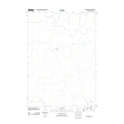
2012 Map of Hereford SW
USGS Topo · Published 2012About this map
The Belle Fourche River winds through this section of Meade County, creating a distinctive hydrological corridor through the Great Plains. The landscape is defined by its drainage patterns, most notably Alkali Cr and the topographical depression of Boydson Draw. This 2012 survey illustrates the section-line road system characteristic of the American West, with a network of corridors like 157th Ave and 217th St providing access to the sprawling rangeland. The map highlights the sparse, rural nature of the region where transportation routes are dictated by the underlying terrain and the path of the river, offering a precise look at the land's contemporary geometry.
Find a feature on this map
8 named features on this map. Tap any name to fly to it.
Don’t see what you’re looking for? This feature index may not catch every label — zoom into the map to look around manually.
Map Details
Editions of this 2012 Hereford SW Map
This is the sole edition of this map. No revisions or reprints were ever made.
Other maps of this area

1893 · Rapid
USGS Topo · 1:125,000

1898 · Rapid
USGS Topo · 1:125,000

1903 · Rapid
USGS Topo · 1:125,000

1953 · Bend
USGS Topo · 1:24,000

1953 · Viewfield
USGS Topo · 1:24,000

1953 · Hereford SE
USGS Topo · 1:24,000

1953 · Hereford
USGS Topo · 1:24,000

1953 · Hereford SW
USGS Topo · 1:24,000

1953 · Rapid City 1 NE
USGS Topo · 1:24,000

1953 · Rapid City 1 SE
USGS Topo · 1:24,000