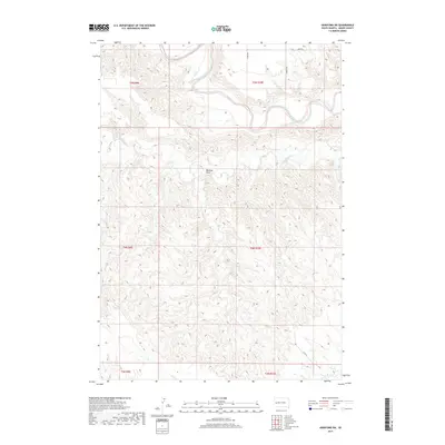
2017 Map of Hereford SW
USGS Topo · Published 2017About this map
The Belle Fourche River carves a winding path through the northern reaches of this Meade County landscape, defining the local topography with its intricate meanders and alluvial benches. To the south, the terrain becomes increasingly dissected, characterized by the drainage patterns of Alkali Cr and the prominent Boydson Draw. This 2017 survey reflects a sparsely populated ranching or agricultural region where the section lines of the Public Land Survey System dictate the sparse road network. Rural access is maintained through a handful of named routes like 157th Ave and Wuring Rd, which traverse the high ground between the river valley and the broken plains to the south. The map captures a moment in the modern era where traditional land divisions remain the primary structure for habitation and transit across this South Dakota prairie.
Find a feature on this map
13 named features on this map. Tap any name to fly to it.
Don’t see what you’re looking for? This feature index may not catch every label — zoom into the map to look around manually.
Map Details
Editions of this 2017 Hereford SW Map
This is the sole edition of this map. No revisions or reprints were ever made.
Other maps of this area

1893 · Rapid
USGS Topo · 1:125,000

1898 · Rapid
USGS Topo · 1:125,000

1903 · Rapid
USGS Topo · 1:125,000

1953 · Bend
USGS Topo · 1:24,000

1953 · Viewfield
USGS Topo · 1:24,000

1953 · Hereford SE
USGS Topo · 1:24,000

1953 · Hereford
USGS Topo · 1:24,000

1953 · Hereford SW
USGS Topo · 1:24,000

1953 · Rapid City 1 NE
USGS Topo · 1:24,000

1953 · Rapid City 1 SE
USGS Topo · 1:24,000