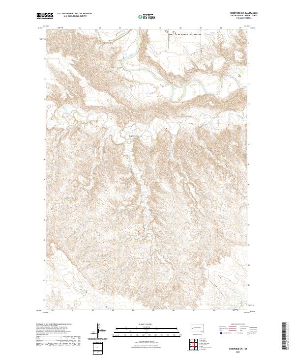
2021 Map of Hereford SW
USGS Topo · Published 2021About this map
The Belle Fourche River meanders through the northern reaches of this Meade County landscape, defining the local drainage and topography in a region marked by significant elevation changes. This modern survey illustrates the rugged drainage systems that feed into the river, most notably Alkali Cr and the prominent Boydson Draw. The land is organized by the Public Land Survey System, with township and range lines like t4n r10e and t5n r9e providing a grid-based framework over the natural terrain. Development remains sparse, concentrated primarily along a network of rural routes such as Wuring Rd and 157th Ave. This map is particularly useful for understanding the current hydrography and access points in this portion of South Dakota, where the interplay between the river valley and the dissected upland draws creates a complex physical environment.
Find a feature on this map
13 named features on this map. Tap any name to fly to it.
Don’t see what you’re looking for? This feature index may not catch every label — zoom into the map to look around manually.
Map Details
Editions of this 2021 Hereford SW Map
This is the sole edition of this map. No revisions or reprints were ever made.
Other maps of this area

1893 · Rapid
USGS Topo · 1:125,000

1898 · Rapid
USGS Topo · 1:125,000

1903 · Rapid
USGS Topo · 1:125,000

1953 · Bend
USGS Topo · 1:24,000

1953 · Viewfield
USGS Topo · 1:24,000

1953 · Hereford SE
USGS Topo · 1:24,000

1953 · Hereford
USGS Topo · 1:24,000

1953 · Hereford SW
USGS Topo · 1:24,000

1953 · Rapid City 1 NE
USGS Topo · 1:24,000

1953 · Rapid City 1 SE
USGS Topo · 1:24,000