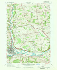
1943 Map of Herkimer
USGS Topo · Published 1971About this map
The Mohawk River valley serves as a bustling corridor of transportation and industry during this mid-century period, where the Erie Canal and the New York Central railroad run parallel through the heart of Herkimer. This survey documents a landscape defined by its evolution, featuring the original waterway alongside the Erie Canal (Abandoned), illustrating the shifting infrastructure of New York's historic trade routes. Beyond the river valley, the terrain rises toward Schrader Hill and Shoemaker Hill, where a network of rural schoolhouses like Shells Bush Sch, Fiddletown Sch, and Locust Grove Sch anchor small farming communities.
Find a feature on this map
39 named features on this map. Tap any name to fly to it.
Don’t see what you’re looking for? This feature index may not catch every label — zoom into the map to look around manually.
Map Details
Editions of this 1943 Herkimer Map
2 editions found
Other maps of this area

1898 · Utica
USGS Topo · 1:62,500

1900 · Little Falls
USGS Topo · 1:62,500

1900 · Utica
USGS Topo · 1:62,500

1903 · Richfield Springs
USGS Topo · 1:62,500

1903 · Little Falls
USGS Topo · 1:62,500

1907 · Winfield
USGS Topo · 1:62,500

1939 · Little Falls
USGS Topo · 1:62,500

1943 · Newport
USGS Topo · 1:24,000

1943 · Jordanville
USGS Topo · 1:24,000
1943 · Herkimer
USGS Topo · 1:24,000