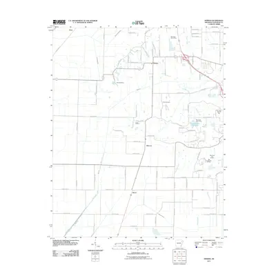
2011 Map of Herman
USGS Topo · Published 2011About this map
Gibson and Gilkerson anchor this portion of Craighead County, revealing a landscape defined by an extensive network of managed waterways and agricultural drainage systems. The area is intersected by numerous named channels such as Whaley Slough Ditch, Steep Cut Creek, and Black Fork Ditch, which speak to the complex water management required for the local geography. Several small dams, including Big Creek Site 11 Dam and Big Creek Site 13 Dam, have created catchments like the Big Creek Site 13 Reservoir and Cole Pond. Local history is preserved at the Gibson Cemetery and Bishop Cemetery, while smaller settlements such as Herman and Nemo dot the northern reaches. This 2011 survey captures the region as a sophisticated drainage basin where natural features like Rogers Bayou and Shelton Creek have been integrated into a modern grid of rural county roads.
Find a feature on this map
94 named features on this map. Tap any name to fly to it.
Don’t see what you’re looking for? This feature index may not catch every label — zoom into the map to look around manually.
Map Details
Editions of this 2011 Herman Map
This is the sole edition of this map. No revisions or reprints were ever made.
Other maps of this area

1935 · Sedgwick
USGS Topo · 1:62,500

1939 · Weiner
USGS Topo · 1:62,500

1939 · Jonesboro
USGS Topo · 1:62,500

1940 · Dee
USGS Topo · 1:62,500

1953 · Memphis
USGS Topo · 1:250,000

1956 · Memphis
USGS Topo · 1:250,000

1958 · Dee
USGS Topo · 1:62,500

1958 · Jonesboro
USGS Topo · 1:62,500

1959 · Weiner
USGS Topo · 1:62,500

1959 · Sedgwick
USGS Topo · 1:62,500