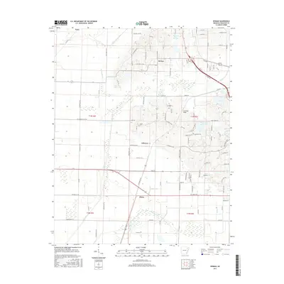
2017 Map of Herman
USGS Topo · Published 2017About this map
Crowleys Ridge rises above the alluvial plains of Craighead County, shaping the settlement patterns and drainage of this Arkansas landscape. This 2017 survey details a transition from the elevated terrain near Herman and Gilkerson to the low-lying agricultural drainage networks to the west and south. The map documents an intricate system of water management, featuring several man-made channels such as Whaley Slough Ditch, Ark Slough Ditch, and Black Fork Ditch, which redirect water around the ridge's base. For genealogists and local historians, the sheet preserves the locations of Bishop Cem and Gibson Cem, alongside small communities like Gibson and Nemo. The intersection of land and water is further marked by the Big Creek Site 11 Reservoir and Big Creek Site 13 Reservoir, reflecting modern conservation and water control efforts in the region.
Find a feature on this map
110 named features on this map. Tap any name to fly to it.
Don’t see what you’re looking for? This feature index may not catch every label — zoom into the map to look around manually.
Map Details
Editions of this 2017 Herman Map
This is the sole edition of this map. No revisions or reprints were ever made.
Other maps of this area

1935 · Sedgwick
USGS Topo · 1:62,500

1939 · Weiner
USGS Topo · 1:62,500

1939 · Jonesboro
USGS Topo · 1:62,500

1940 · Dee
USGS Topo · 1:62,500

1953 · Memphis
USGS Topo · 1:250,000

1956 · Memphis
USGS Topo · 1:250,000

1958 · Dee
USGS Topo · 1:62,500

1958 · Jonesboro
USGS Topo · 1:62,500

1959 · Weiner
USGS Topo · 1:62,500

1959 · Sedgwick
USGS Topo · 1:62,500