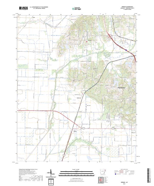
2024 Map of Herman
USGS Topo · Published 2024About this map
Crowleys Ridge rises above the alluvial plains of Craighead County, creating a distinct topographical divide that has historically influenced the settlement patterns of northeast Arkansas. This elevation change separates the western agricultural drainage systems, including the Whaley-Slough Ditch and Ark Slough Ditch, from the urban expansion of Jonesboro on the eastern slopes. The rural character of the landscape is defined by small crossroads communities and family-centered landmarks such as Bishop Cem and Gibson Cem, which serve as anchors for local genealogy. Industrial and transportation infrastructure like the RBC Airport and the managed flow of Big Creek illustrate the intersection of modern logistics and the traditional land management of the Farm Service Agency Interest of Arkansas. The map reveals the persistence of early settlements like Gilkerson, Herman, and Nemo amidst a network of modern county roads and expanding residential developments.
Find a feature on this map
116 named features on this map. Tap any name to fly to it.
Don’t see what you’re looking for? This feature index may not catch every label — zoom into the map to look around manually.
Map Details
Editions of this 2024 Herman Map
This is the sole edition of this map. No revisions or reprints were ever made.
Other maps of this area

1935 · Sedgwick
USGS Topo · 1:62,500

1939 · Weiner
USGS Topo · 1:62,500

1939 · Jonesboro
USGS Topo · 1:62,500

1940 · Dee
USGS Topo · 1:62,500

1953 · Memphis
USGS Topo · 1:250,000

1956 · Memphis
USGS Topo · 1:250,000

1958 · Dee
USGS Topo · 1:62,500

1958 · Jonesboro
USGS Topo · 1:62,500

1959 · Weiner
USGS Topo · 1:62,500

1959 · Sedgwick
USGS Topo · 1:62,500