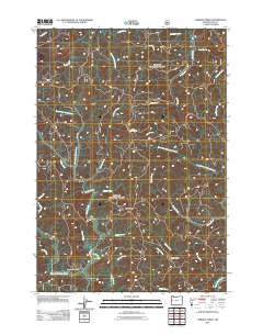
2011 Map of Herman Creek
USGS Topo · Published 2011About this map
Reed stands as a small settlement hub within this 2011 survey of Lane County's forested interior. The landscape is defined by an intricate network of waterways, including the winding Five Rivers and Herman Creek, which drain the steep terrain between Taylor Ridge and Failor Ridge. This map illustrates the intersection of timber-focused infrastructure and local history, where Five Rivers Lookout monitors the canopy while Indian Creek Cemetery provides a tangible link to the area's early residents. The topographic detail reveals the deep drainages of Misery Creek and Deadwood Creek, showing how the natural hydrology dictated the path of local corridors like Indian Creek Rd and Five Rivers Rd. This edition reflects the area's modern character as a managed forest environment where recreational and industrial access routes follow the same historic creek beds.
Find a feature on this map
32 named features on this map. Tap any name to fly to it.
Don’t see what you’re looking for? This feature index may not catch every label — zoom into the map to look around manually.
Map Details
Editions of this 2011 Herman Creek Map
This is the sole edition of this map. No revisions or reprints were ever made.
Other maps of this area

1918 · Mapleton
USGS Topo · 1:48,000

1940 · Mapleton
USGS Topo · 1:62,500

1941 · Blachly
USGS Topo · 1:62,500

1942 · Alsea
USGS Topo · 1:62,500

1942 · Blachly
USGS Topo · 1:62,500

1942 · Tidewater
USGS Topo · 1:62,500

1945 · Mapleton
USGS Topo · 1:62,500

1953 · Salem
USGS Topo · 1:250,000

1954 · Salem
USGS Topo · 1:250,000

1956 · Alsea
USGS Topo · 1:62,500