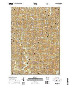
2020 Map of Herman Creek
USGS Topo · Published 2020About this map
The Reed settlement and the upper reaches of the Siuslaw National Forest characterize this section of the Oregon Coast Range. This high-relief landscape is defined by the heavy drainage patterns of Five Rivers and the Green River, which carve through the steep timberlands. Significant local landmarks such as Taylor Ridge and Failor Ridge divide the numerous drainages, including Taylor Cr, Gibson Cr, and Misery Cr. The terrain is marked by a complex network of forest service roads and timber management trails that follow the contours of the various creek forks, such as N Fork Indian Cr and W Fork Deadwood Cr. This modern survey details the intricate hydrography of the western Cascades foothills, showing the vital connection between these headwaters and the regional watershed.
Find a feature on this map
33 named features on this map. Tap any name to fly to it.
Don’t see what you’re looking for? This feature index may not catch every label — zoom into the map to look around manually.
Map Details
Editions of this 2020 Herman Creek Map
This is the sole edition of this map. No revisions or reprints were ever made.
Other maps of this area

1918 · Mapleton
USGS Topo · 1:48,000

1940 · Mapleton
USGS Topo · 1:62,500

1941 · Blachly
USGS Topo · 1:62,500

1942 · Alsea
USGS Topo · 1:62,500

1942 · Blachly
USGS Topo · 1:62,500

1942 · Tidewater
USGS Topo · 1:62,500

1945 · Mapleton
USGS Topo · 1:62,500

1953 · Salem
USGS Topo · 1:250,000

1954 · Salem
USGS Topo · 1:250,000

1956 · Alsea
USGS Topo · 1:62,500