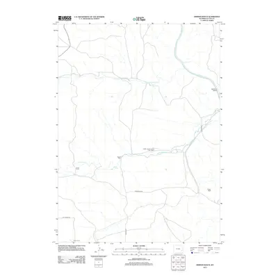
2012 Map of Herman Ranch
USGS Topo · Published 2012About this map
Herman Ranch and other established family holdings define the rural character of this Platte County landscape. The land is etched by the N Platte River as it passes through Wendover Canyon in the northeast, while the broader topography is shaped by seasonal drainages like Little Cottonwood Cr and Cottonwood Cr. The settlement pattern centers on ranching operations such as Russel Ranch and Pepper Ranch, reflecting the enduring agricultural heritage of the High Plains. Transportation in the area relies on a network of unpaved corridors including Cottonwood Rd and Wendover Rd, which connect these remote outposts. A notable modern landmark is the Snell - North Laramie River Airport, situated near the confluence of local creek beds and providing a vital link for this isolated ranching community.
Find a feature on this map
14 named features on this map. Tap any name to fly to it.
Don’t see what you’re looking for? This feature index may not catch every label — zoom into the map to look around manually.
Map Details
Editions of this 2012 Herman Ranch Map
This is the sole edition of this map. No revisions or reprints were ever made.
Other maps of this area

1896 · Hartville
USGS Topo · 1:125,000

1901 · Hartville
USGS Topo · 1:125,000

1950 · Coleman Butte
USGS Topo · 1:24,000

1950 · Herman Ranch
USGS Topo · 1:24,000

1950 · Haushar Ranch
USGS Topo · 1:24,000

1950 · Guernsey Reservoir
USGS Topo · 1:24,000

1951 · Coleman Butte
USGS Topo · 1:24,000

1951 · Sibley Peak
USGS Topo · 1:24,000

1951 · Haushar Ranch
USGS Topo · 1:24,000

1951 · Guernsey Reservoir
USGS Topo · 1:24,000