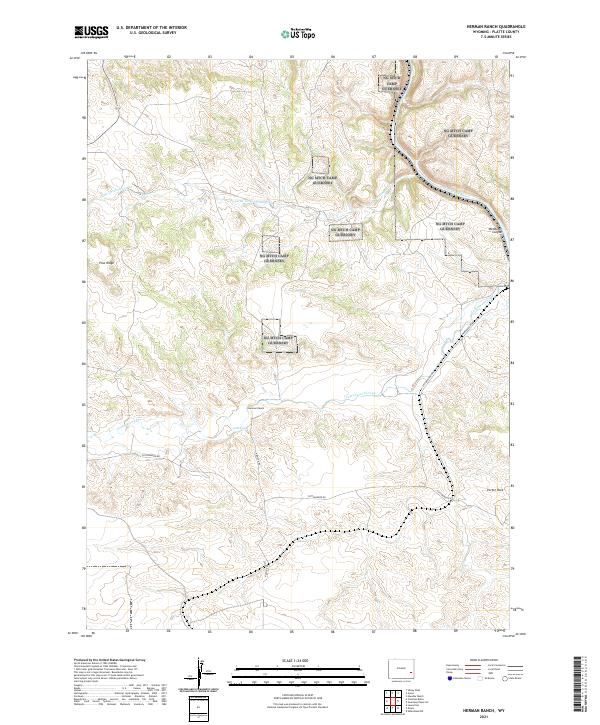
2021 Map of Herman Ranch
USGS Topo · Published 2021About this map
Herman Ranch sits at the heart of this Platte County landscape, situated near Cold Spring where the high plains break into a series of deeply incised canyons. The terrain is defined by the winding course of the North Platte River as it carves through Wendover Canyon in the northeast, creating a dramatic topographical transition. In the western portion of the sheet, the elevation rises toward Pine Ridge, a prominent feature that overlooks the drainage systems of Little Cottonwood Cr and Cottonwood Creek.
Find a feature on this map
18 named features on this map. Tap any name to fly to it.
Don’t see what you’re looking for? This feature index may not catch every label — zoom into the map to look around manually.
Map Details
Editions of this 2021 Herman Ranch Map
This is the sole edition of this map. No revisions or reprints were ever made.
Other maps of this area

1896 · Hartville
USGS Topo · 1:125,000

1901 · Hartville
USGS Topo · 1:125,000

1950 · Coleman Butte
USGS Topo · 1:24,000

1950 · Herman Ranch
USGS Topo · 1:24,000

1950 · Haushar Ranch
USGS Topo · 1:24,000

1950 · Guernsey Reservoir
USGS Topo · 1:24,000

1951 · Coleman Butte
USGS Topo · 1:24,000

1951 · Sibley Peak
USGS Topo · 1:24,000

1951 · Haushar Ranch
USGS Topo · 1:24,000

1951 · Guernsey Reservoir
USGS Topo · 1:24,000