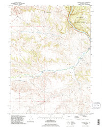
1990 Map of Herman Ranch
USGS Topo · Published 1995About this map
The North Platte River cuts a deep corridor through this portion of Platte County, where the historical path of westward migration is etched into the landscape. The Emigrant Trail traverses the terrain, marked by several Oregon Trail Markers and reflecting the deep roots of 19th-century transit. Ranching life is anchored by family-named sites such as Herman Ranch and Russel Ranch, while the northeast corner is dominated by the Camp Guernsey State Military Reservation.
Find a feature on this map
16 named features on this map. Tap any name to fly to it.
Don’t see what you’re looking for? This feature index may not catch every label — zoom into the map to look around manually.
Map Details
Editions of this 1990 Herman Ranch Map
This is the sole edition of this map. No revisions or reprints were ever made.
Other maps of this area

1896 · Hartville
USGS Topo · 1:125,000

1901 · Hartville
USGS Topo · 1:125,000

1950 · Coleman Butte
USGS Topo · 1:24,000

1950 · Herman Ranch
USGS Topo · 1:24,000

1950 · Haushar Ranch
USGS Topo · 1:24,000

1950 · Guernsey Reservoir
USGS Topo · 1:24,000

1951 · Coleman Butte
USGS Topo · 1:24,000

1951 · Sibley Peak
USGS Topo · 1:24,000

1951 · Haushar Ranch
USGS Topo · 1:24,000

1951 · Guernsey Reservoir
USGS Topo · 1:24,000