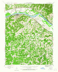
1942 Map of Hermann
USGS Topo · Published 1965About this map
The Missouri River town of Hermann serves as the focal point of this 1940s-era landscape, where the Missouri Pacific railroad tracks follow the river's southern bank. The terrain south of the river is densely dissected by a network of creeks, including Frene Creek and Big Berger Creek, which helped shape the distribution of small rural settlements like Stony Hill and Dissen. This survey provides a remarkably detailed look at the rural social infrastructure of the mid-20th century, documenting dozens of neighborhood schools and churches that once anchored these hillside communities.
Find a feature on this map
62 named features on this map. Tap any name to fly to it.
Don’t see what you’re looking for? This feature index may not catch every label — zoom into the map to look around manually.
Map Details
Editions of this 1942 Hermann Map
2 editions found

Other maps of this area

1890 · Hermann
USGS Topo · 1:125,000

1890 · Fulton
USGS Topo · 1:125,000

1903 · Sullivan
USGS Topo · 1:125,000

1934 · Bland
USGS Topo · 1:62,500

1935 · Gerald
USGS Topo · 1:48,000

1935 · Morrison
USGS Topo · 1:48,000

1936 · Hermann
USGS Topo · 1:48,000

1937 · Bland
USGS Topo · 1:62,500

1940 · Montgomery City
USGS Topo · 1:62,500

1941 · Gerald
USGS Topo · 1:62,500