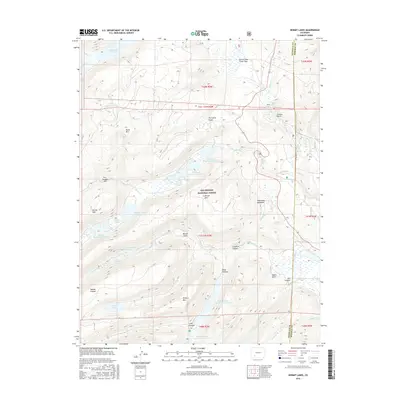
2016 Map of Hermit Lakes
USGS Topo · Published 2016About this map
Rio Grande National Forest encompasses the high-altitude terrain of Mineral County, where a complex network of man-made and natural water features defines the landscape. This 2016 survey highlights a sophisticated system of water management, including the Continental Reservoir in the north and the multi-staged S Lazy U Reservoirs and Road Canyon Reservoir Number 1 to the south. The area is characterized by dramatic elevation shifts and named peaks such as Minnie Mtn and Shotgun Mtn, while the Rio Grande itself flows through the southern reaches of the quadrangle.
Find a feature on this map
52 named features on this map. Tap any name to fly to it.
Don’t see what you’re looking for? This feature index may not catch every label — zoom into the map to look around manually.
Map Details
Editions of this 2016 Hermit Lakes Map
This is the sole edition of this map. No revisions or reprints were ever made.
Other maps of this area

1905 · San Cristobal
USGS Topo · 1:125,000

1907 · San Cristobal
USGS Topo · 1:125,000

1945 · Durango
USGS Topo · 1:250,000

1953 · Durango
USGS Topo · 1:250,000

1954 · Durango
USGS Topo · 1:250,000

1959 · Bristol Head
USGS Topo · 1:62,500

1961 · Durango
USGS Topo · 1:250,000

1963 · Durango
USGS Topo · 1:250,000
1964 · Finger Mesa
USGS Topo · 1:24,000
1964 · Little Squaw Creek
USGS Topo · 1:24,000