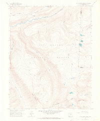
1964 Map of Little Squaw Creek
USGS Topo · Published 1967About this map
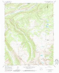
Continental Divide winds across this high-altitude landscape of Hinsdale and Mineral counties, marking the hydrological boundary between the Rio Grande National Forest and San Juan National Forest. In the mid-1960s, the upper reaches of the Rio Grande are defined by sharp elevation changes at River Hill and the narrow passage of Box Canyon. Human presence is largely tied to seasonal resource management and recreation, evidenced by the River Hill Campground and a network of specialized routes including the Stock Driveway, Jeep Trail, and various Pack Trails. Several alpine water bodies, such as Ruby Lake, Fuchs Reservoir, and the Red Lakes, sit within steep basins. Landforms like Chief Mountain and the aptly named Knife Edge dominate the southern portion of the quadrangle, illustrating the complex drainage patterns of Little Squaw Creek and Texas Creek.
Find a feature on this map
33 named features on this map. Tap any name to fly to it.
Don’t see what you’re looking for? This feature index may not catch every label — zoom into the map to look around manually.
Map Details
Editions of this 1964 Little Squaw Creek Map
5 editions found
Other maps of this area

1905 · San Cristobal
USGS Topo · 1:125,000

1907 · San Cristobal
USGS Topo · 1:125,000

1945 · Durango
USGS Topo · 1:250,000

1953 · Durango
USGS Topo · 1:250,000

1954 · Durango
USGS Topo · 1:250,000

1959 · Bristol Head
USGS Topo · 1:62,500

1961 · Durango
USGS Topo · 1:250,000

1963 · Durango
USGS Topo · 1:250,000
1964 · Finger Mesa
USGS Topo · 1:24,000
1964 · Weminuche Pass
USGS Topo · 1:24,000