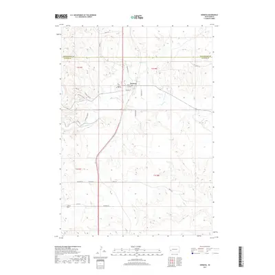
2017 Map of Hermosa
USGS Topo · Published 2017About this map
Hermosa sits at the transition between the plains and the Black Hills foothills, serving as a primary settlement along the winding course of Battle Cr. The town layout is clearly defined by local streets such as Main St and Vilas St, with the Highland Park Cem situated to the west. A unique element of the modern landscape is the presence of Missile Rd and Missile Rd W to the south, hinting at the region's historical military infrastructure and strategic significance.
Find a feature on this map
30 named features on this map. Tap any name to fly to it.
Don’t see what you’re looking for? This feature index may not catch every label — zoom into the map to look around manually.
Map Details
Editions of this 2017 Hermosa Map
This is the sole edition of this map. No revisions or reprints were ever made.
Other maps of this area

1894 · Hermosa
USGS Topo · 1:125,000

1901 · Hermosa
USGS Topo · 1:125,000

1953 · Hermosa NW
USGS Topo · 1:24,000

1953 · Hermosa
USGS Topo · 1:24,000

1953 · Hermosa SE
USGS Topo · 1:24,000
1953 · Hermosa NE
USGS Topo · 1:24,000
1954 · Rockerville
USGS Topo · 1:24,000

1954 · Hayward
USGS Topo · 1:24,000

1954 · Mount Rushmore
USGS Topo · 1:62,500

1955 · Hot Springs
USGS Topo · 1:250,000