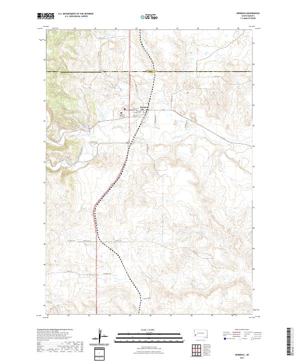
2021 Map of Hermosa
USGS Topo · Published 2021About this map
Hermosa anchors this 2021 landscape at the edge of the Black Hills, situated at the junction of Main St and Highway 79. The town's grid is punctuated by local landmarks like the Highland Park Cem and names like Vilas St and Whitney St. Beyond the settlement, the terrain is defined by a network of drainage ways including Battle Cr, Billover Cr, and the specifically named L Seven Draw. This modern survey records the rural layout of the region, where family-named routes such as Shorb Rd, Hasselstrom Pl, and Mielke Pl connect scattered homesteads and ranches. Of particular interest are the distinctively named Missile Rd and Missile Rd W, which hint at the strategic military geography common in the Western Dakotas during the late twentieth century.
Find a feature on this map
35 named features on this map. Tap any name to fly to it.
Don’t see what you’re looking for? This feature index may not catch every label — zoom into the map to look around manually.
Map Details
Editions of this 2021 Hermosa Map
This is the sole edition of this map. No revisions or reprints were ever made.
Other maps of this area

1894 · Hermosa
USGS Topo · 1:125,000

1901 · Hermosa
USGS Topo · 1:125,000

1953 · Hermosa NW
USGS Topo · 1:24,000

1953 · Hermosa
USGS Topo · 1:24,000

1953 · Hermosa SE
USGS Topo · 1:24,000
1953 · Hermosa NE
USGS Topo · 1:24,000
1954 · Rockerville
USGS Topo · 1:24,000

1954 · Hayward
USGS Topo · 1:24,000

1954 · Mount Rushmore
USGS Topo · 1:62,500

1955 · Hot Springs
USGS Topo · 1:250,000