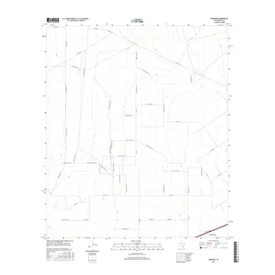
2016 Map of Hermosa
USGS Topo · Published 2016About this map
The settlement of Hermosa anchors the southern edge of this West Texas landscape, where the infrastructure of the energy and ranching industries defines the terrain. Intersecting the plains are specialized routes such as Oil Field Access Rd 101, Gas Line Rd, and Oil Line Rd, illustrating the extensive mid-20th-century development of the Permian Basin's resources. The map reveals a grid of utility and service roads including Farm Access Rd 105 and Fence Line Rd 115 that segment the open country between local landmarks like Sand Pit Rd 101. For the researcher, this survey documents the specific placement of pipelines and extraction-related pathways like Well Access Rd 103, providing a clear record of the land's industrial use and property divisions in Reeves County during the early twenty-first century.
Find a feature on this map
41 named features on this map. Tap any name to fly to it.
Don’t see what you’re looking for? This feature index may not catch every label — zoom into the map to look around manually.
Map Details
Editions of this 2016 Hermosa Map
This is the sole edition of this map. No revisions or reprints were ever made.
Other maps of this area

1921 · Toyah
USGS Topo · 1:125,000

1954 · Pecos
USGS Topo · 1:250,000

1957 · Pecos
USGS Topo · 1:250,000

1961 · Sand Lake
USGS Topo · 1:24,000
1968 · Halamicek Ranch
USGS Topo · 1:24,000

1968 · Mentone SW
USGS Topo · 1:24,000

1970 · Hermosa SW
USGS Topo · 1:24,000

1970 · Big Hill
USGS Topo · 1:24,000

1970 · Toyah
USGS Topo · 1:24,000
1970 · Hermosa
USGS Topo · 1:24,000