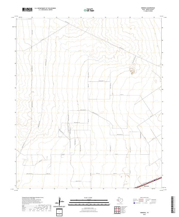
2022 Map of Hermosa
USGS Topo · Published 2022About this map
Hermosa anchors the southeast corner of this West Texas landscape, positioned along the I-20 Svc Rd corridor. The surrounding terrain is a complex network of industrial and agricultural access, dominated by the energy sector and cattle ranching. Large-scale utility infrastructure is prominent, marked by the long reaches of Gas Line Rd and Oil Line Rd cutting across the northern reaches of the quadrangle.
Find a feature on this map
36 named features on this map. Tap any name to fly to it.
Don’t see what you’re looking for? This feature index may not catch every label — zoom into the map to look around manually.
Map Details
Editions of this 2022 Hermosa Map
This is the sole edition of this map. No revisions or reprints were ever made.
Other maps of this area

1921 · Toyah
USGS Topo · 1:125,000

1954 · Pecos
USGS Topo · 1:250,000

1957 · Pecos
USGS Topo · 1:250,000

1961 · Sand Lake
USGS Topo · 1:24,000
1968 · Halamicek Ranch
USGS Topo · 1:24,000

1968 · Mentone SW
USGS Topo · 1:24,000

1970 · Hermosa SW
USGS Topo · 1:24,000

1970 · Big Hill
USGS Topo · 1:24,000

1970 · Toyah
USGS Topo · 1:24,000
1970 · Hermosa
USGS Topo · 1:24,000