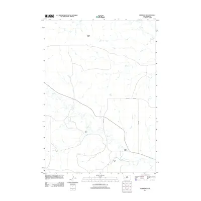
2012 Map of Hermosa SE
USGS Topo · Published 2012About this map
Flattop Butte and Yankee Hill define the topographic character of this Pennington County landscape as it appeared in the early 21st century. The terrain is marked by a series of drainage systems, most notably Seven Draw and Reed Draw, which channel towards the prominent riparian corridors of Spring Cr in the north and Battle Cr in the south. This area demonstrates a sprawling, low-density rural road network, with arteries like Co Hwy-10 and Co Hwy-152 providing essential connectivity across the plains. Local infrastructure is further detailed through named routes such as Baker Rd and 152nd Ave, reflecting a landscape primarily shaped by modern agricultural or ranching transit patterns rather than concentrated township centers.
Find a feature on this map
10 named features on this map. Tap any name to fly to it.
Don’t see what you’re looking for? This feature index may not catch every label — zoom into the map to look around manually.
Map Details
Editions of this 2012 Hermosa SE Map
This is the sole edition of this map. No revisions or reprints were ever made.
Other maps of this area

1894 · Hermosa
USGS Topo · 1:125,000

1901 · Hermosa
USGS Topo · 1:125,000

1951 · Red Shirt
USGS Topo · 1:24,000

1953 · Hermosa NW
USGS Topo · 1:24,000

1953 · Hermosa
USGS Topo · 1:24,000

1953 · Caputa
USGS Topo · 1:24,000

1953 · Hermosa SE
USGS Topo · 1:24,000
1953 · Hermosa NE
USGS Topo · 1:24,000

1953 · Caputa SW
USGS Topo · 1:24,000

1955 · Hot Springs
USGS Topo · 1:250,000