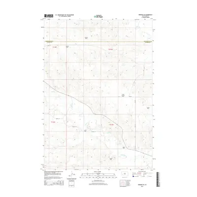
2015 Map of Hermosa SE
USGS Topo · Published 2015About this map
The high plains and drainage systems of the Black Hills foothills define this 2015 survey of the border between Pennington and Custer counties. Notable landforms like Flattop Butte and Yankee Hill punctuate a landscape carved by intricate draws and gulches, including Charles Draw and Lauzon Gulch. This area is characterized by the flow of Spring Cr and Battle Creek, which have shaped the topography and dictated the historical placement of roads.
Find a feature on this map
20 named features on this map. Tap any name to fly to it.
Don’t see what you’re looking for? This feature index may not catch every label — zoom into the map to look around manually.
Map Details
Editions of this 2015 Hermosa SE Map
This is the sole edition of this map. No revisions or reprints were ever made.
Other maps of this area

1894 · Hermosa
USGS Topo · 1:125,000

1901 · Hermosa
USGS Topo · 1:125,000

1951 · Red Shirt
USGS Topo · 1:24,000

1953 · Hermosa NW
USGS Topo · 1:24,000

1953 · Hermosa
USGS Topo · 1:24,000

1953 · Caputa
USGS Topo · 1:24,000

1953 · Hermosa SE
USGS Topo · 1:24,000
1953 · Hermosa NE
USGS Topo · 1:24,000

1953 · Caputa SW
USGS Topo · 1:24,000

1955 · Hot Springs
USGS Topo · 1:250,000