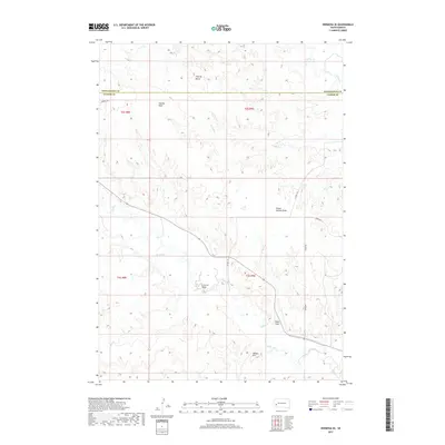
2017 Map of Hermosa SE
USGS Topo · Published 2017About this map
Flattop Butte rises above the drainage-scarred landscape south of the Black Hills, marking a terrain defined by deep erosional cuts and intermittent watercourses. In this section of South Dakota, the land is etched by a series of named draws, including Charles Draw, School Section Draw, Seven Draw, and Reed Draw, which channel seasonal runoff toward the more substantial Battle Creek. The boundary between Pennington and Custer counties runs horizontally through the northern half of the area, separating township ranges T2S and T3S.
Find a feature on this map
18 named features on this map. Tap any name to fly to it.
Don’t see what you’re looking for? This feature index may not catch every label — zoom into the map to look around manually.
Map Details
Editions of this 2017 Hermosa SE Map
This is the sole edition of this map. No revisions or reprints were ever made.
Other maps of this area

1894 · Hermosa
USGS Topo · 1:125,000

1901 · Hermosa
USGS Topo · 1:125,000

1951 · Red Shirt
USGS Topo · 1:24,000

1953 · Hermosa NW
USGS Topo · 1:24,000

1953 · Hermosa
USGS Topo · 1:24,000

1953 · Caputa
USGS Topo · 1:24,000

1953 · Hermosa SE
USGS Topo · 1:24,000
1953 · Hermosa NE
USGS Topo · 1:24,000

1953 · Caputa SW
USGS Topo · 1:24,000

1955 · Hot Springs
USGS Topo · 1:250,000