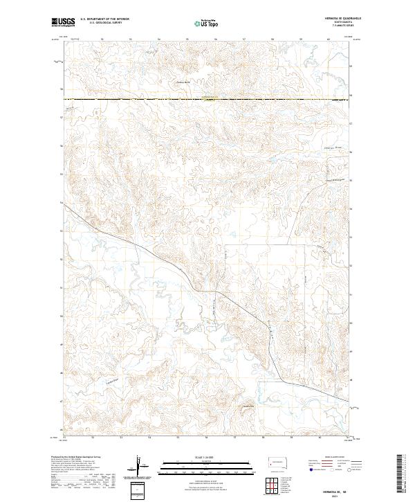
2021 Map of Hermosa SE
USGS Topo · Published 2021About this map
Spring Cr and Battle Creek drain this South Dakota landscape where the boundaries of Pennington and Custer counties meet. The terrain is defined by a series of named drainages that cut through the high plains, including Charles Draw, Reed Draw, and School Section Draw. These features reflect a traditional Western land-use pattern where water access and natural topography dictated property lines and transportation routes. Notable elevations like Flattop Butte and Yankee Hill rise above the surrounding draws, serving as key landmarks for navigators and local residents. While the area is largely rural, the network of local roads such as Co Hwy 152 and the Spring Creek Cutoff provides insight into the modern connectivity between the scattered ranches and seasonal waterways of the Black Hills foothills.
Find a feature on this map
19 named features on this map. Tap any name to fly to it.
Don’t see what you’re looking for? This feature index may not catch every label — zoom into the map to look around manually.
Map Details
Editions of this 2021 Hermosa SE Map
This is the sole edition of this map. No revisions or reprints were ever made.
Other maps of this area

1894 · Hermosa
USGS Topo · 1:125,000

1901 · Hermosa
USGS Topo · 1:125,000

1951 · Red Shirt
USGS Topo · 1:24,000

1953 · Hermosa NW
USGS Topo · 1:24,000

1953 · Hermosa
USGS Topo · 1:24,000

1953 · Caputa
USGS Topo · 1:24,000

1953 · Hermosa SE
USGS Topo · 1:24,000
1953 · Hermosa NE
USGS Topo · 1:24,000

1953 · Caputa SW
USGS Topo · 1:24,000

1955 · Hot Springs
USGS Topo · 1:250,000