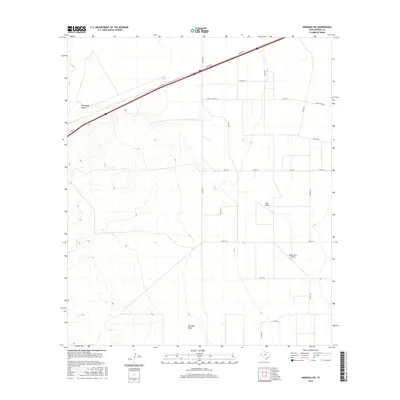
2016 Map of Hermosa SW
USGS Topo · Published 2016About this map
Billingslea Draw cuts across the arid landscape of western Reeves County, defining a drainage pattern that flows through this high-desert region. The terrain is structured by a network of county roads and ranch access routes, reflecting a ranching economy that relies on expansive land use and sparse infrastructure. The presence of Gnaws Farm Airport in the southeastern quadrant suggests a reliance on private aviation for transport and agricultural operations in this part of West Texas. Water features like Salt Draw and Ninemile Draw illustrate the seasonal hydrology of the area, where dry creek beds become critical conduits during infrequent rain events. Modern transportation is represented by the i20 SVC RD in the north, while local life centers around routes like Fm 1934 and Ranch Rd 1934.
Find a feature on this map
21 named features on this map. Tap any name to fly to it.
Don’t see what you’re looking for? This feature index may not catch every label — zoom into the map to look around manually.
Map Details
Editions of this 2016 Hermosa SW Map
This is the sole edition of this map. No revisions or reprints were ever made.
Other maps of this area

1921 · Toyah
USGS Topo · 1:125,000

1954 · Pecos
USGS Topo · 1:250,000

1955 · Saragosa
USGS Topo · 1:62,500

1957 · Pecos
USGS Topo · 1:250,000

1970 · Hermosa SW
USGS Topo · 1:24,000

1970 · Florenzo Hill
USGS Topo · 1:24,000

1970 · Big Hill
USGS Topo · 1:24,000

1970 · Toyah
USGS Topo · 1:24,000
1970 · Hermosa
USGS Topo · 1:24,000
1970 · Saragosa NW
USGS Topo · 1:24,000