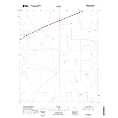
2019 Map of Hermosa SW
USGS Topo · Published 2019About this map
Salt Draw and Billingslea Draw define the drainage patterns of this arid landscape in Reeves County, where the desert floor is crisscrossed by a grid of rural access roads and county lines. The arrival of the interstate era is marked by the presence of the I20 Svc Rd cutting across the northern reaches, serving as a primary artery alongside Fm 1934 and Ranch Rd 1934. A more personal mark on the landscape appears in the southeast at Gnaws Farm Airport, a private landing strip that reflects the region's reliance on small aircraft for managing large ranching or agricultural tracts. The terrain transitions south toward Ninemile Draw, showing a vast, open territory defined more by its dry washes and survey roads like Shaw Rd than by concentrated urban centers.
Find a feature on this map
21 named features on this map. Tap any name to fly to it.
Don’t see what you’re looking for? This feature index may not catch every label — zoom into the map to look around manually.
Map Details
Editions of this 2019 Hermosa SW Map
This is the sole edition of this map. No revisions or reprints were ever made.
Other maps of this area

1921 · Toyah
USGS Topo · 1:125,000

1954 · Pecos
USGS Topo · 1:250,000

1955 · Saragosa
USGS Topo · 1:62,500

1957 · Pecos
USGS Topo · 1:250,000

1970 · Hermosa SW
USGS Topo · 1:24,000

1970 · Florenzo Hill
USGS Topo · 1:24,000

1970 · Big Hill
USGS Topo · 1:24,000

1970 · Toyah
USGS Topo · 1:24,000
1970 · Hermosa
USGS Topo · 1:24,000
1970 · Saragosa NW
USGS Topo · 1:24,000