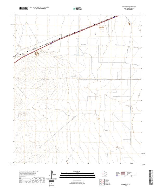
2022 Map of Hermosa SW
USGS Topo · Published 2022About this map
Salt Draw cuts across the northern landscape of this Reeves County region, flanked by the seasonal drainage paths of Billingslea Draw and Ninemile Draw. The area is defined by a sparse but structured network of ranching roads and aviation infrastructure, most notably the Gnaws Farm Airport situated in the southeastern corner. Transportation is anchored by the Interstate 20 corridor, labeled here as i20-SVC-RD-, which runs parallel to the primary drainage. The intersection of rural life and transit is evident in the transition from local routes like Shaw Rd and Co RD 132 to state-maintained paths such as FM 1934 and Ranch Rd 1934. This map documents a modern West Texas landscape where vast drainage basins dictate the placement of roads and small-scale private airfields.
Find a feature on this map
21 named features on this map. Tap any name to fly to it.
Don’t see what you’re looking for? This feature index may not catch every label — zoom into the map to look around manually.
Map Details
Editions of this 2022 Hermosa SW Map
This is the sole edition of this map. No revisions or reprints were ever made.
Other maps of this area

1921 · Toyah
USGS Topo · 1:125,000

1954 · Pecos
USGS Topo · 1:250,000

1955 · Saragosa
USGS Topo · 1:62,500

1957 · Pecos
USGS Topo · 1:250,000

1970 · Hermosa SW
USGS Topo · 1:24,000

1970 · Florenzo Hill
USGS Topo · 1:24,000

1970 · Big Hill
USGS Topo · 1:24,000

1970 · Toyah
USGS Topo · 1:24,000
1970 · Hermosa
USGS Topo · 1:24,000
1970 · Saragosa NW
USGS Topo · 1:24,000