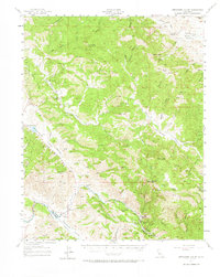
1957 Map of Hernandez Valley
USGS Topo · Published 1967About this map
Hernandez Valley and the surrounding Diablo Range foothills are documented here in the late 1950s, revealing a landscape of isolated ranching outposts and mineral exploration. The San Benito River winds through the central terrain, bordered by steep ridges like Buck Ridge and Cottonwood Ridge. Ranching history is deeply etched into the geography through names like the Lew Smith Ranch and Hepsedam Ranch, while the presence of the Bitterwater-Tully School suggests a community hub for the scattered residents of the Bitterwater Valley. Industrial activity is noted by the Firefly Mine and several scattered oil wells and tanks near Vallecitos. The primary transit corridor of the Airline Highway cuts through the western valleys, providing a vital link for the remote settlements of Lonoak and the various cattle operations that define this region of San Benito County.
Find a feature on this map
76 named features on this map. Tap any name to fly to it.
Don’t see what you’re looking for? This feature index may not catch every label — zoom into the map to look around manually.
Map Details
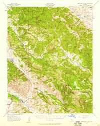
Editions of this 1957 Hernandez Valley Map
2 editions found
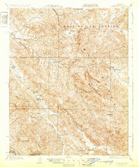
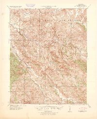
Other maps of this area

1913 · Panoche
USGS Topo · 1:125,000

1915 · Priest Valley
USGS Topo · 1:125,000

1919 · King City
USGS Topo · 1:62,500

1919 · San Benito
USGS Topo · 1:62,500

1921 · Metz
USGS Topo · 1:62,500
1931 · San Benito
USGS Topo · 1:62,500

1939 · King City
USGS Topo · 1:62,500

1940 · Metz
USGS Topo · 1:62,500
1940 · San Benito
USGS Topo · 1:62,500

1941 · Priest Valley
USGS Topo · 1:62,500