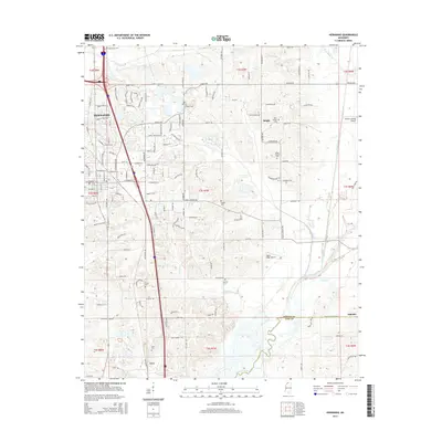
2015 Map of Hernando
USGS Topo · Published 2015About this map
Hernando serves as the focal point of this Mississippi landscape, showing a period of significant residential expansion toward the east and south. The map documents numerous family and community burial grounds that anchor the local history, such as Bethlehem Cem and Bakers Chapel Cem. Outside the main town center, smaller settlements like Bright and Love sit among a dense network of country roads including Holly Springs Rd and Byhalia Rd. The terrain is defined by the drainage systems of Mussacuna Cr and Grays Cr, which eventually lead toward the Coldwater River at the southern boundary. This 2015 survey provides a modern record of the DeSoto County and Tate County line, capturing the transition from suburban development to the rural reaches near Alphaba.
Find a feature on this map
76 named features on this map. Tap any name to fly to it.
Don’t see what you’re looking for? This feature index may not catch every label — zoom into the map to look around manually.
Map Details
Editions of this 2015 Hernando Map
This is the sole edition of this map. No revisions or reprints were ever made.
Other maps of this area

1932 · Horn Lake
USGS Topo · 1:48,000

1932 · Crenshaw
USGS Topo · 1:62,500

1935 · Crenshaw
USGS Topo · 1:62,500

1935 · Horn Lake
USGS Topo · 1:62,500

1944 · Senatobia
USGS Topo · 1:62,500

1944 · Hernando
USGS Topo · 1:62,500

1948 · Helena
USGS Topo · 1:250,000

1950 · Helena
USGS Topo · 1:250,000

1955 · Helena
USGS Topo · 1:250,000

1956 · Tupelo
USGS Topo · 1:250,000