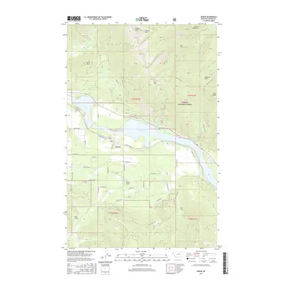
2017 Map of Heron
USGS Topo · Published 2017About this map
The settlement of Heron sits along the southern banks of the Cabinet Gorge Reservoir, a major impoundment of the Clark Fork in western Montana. This 2017 study illustrates the intersection of modern infrastructure and the steep topography of the Cabinet Mountains and Kaniksu National Forest. Local history is anchored by the Heron Cem near the rail corridor of Railroad Ave, while the surrounding landscape is defined by named drainages and peaks like Star Peak and Fatman Mtn. The map reveals a network of rural access roads, such as Elk Creek Rd and Lower River Rd, that navigate the complex gulches and ridges, including Pilik Ridge and Napoleon Gulch. These details provide a clear view of the mountain-and-valley economy, showing how residential pockets like S Sanctuary Loop have developed within the timbered draws and river terraces.
Find a feature on this map
61 named features on this map. Tap any name to fly to it.
Don’t see what you’re looking for? This feature index may not catch every label — zoom into the map to look around manually.
Map Details
Editions of this 2017 Heron Map
This is the sole edition of this map. No revisions or reprints were ever made.
Other maps of this area

1909 · Cataldo
USGS Topo · 1:125,000

1911 · Cataldo
USGS Topo · 1:125,000

1911 · Priest Lake
USGS Topo · 1:250,000

1913 · Priest Lake
USGS Topo · 1:250,000

1920 · Libby
USGS Topo · 1:125,000

1930 · Libby
USGS Topo · 1:125,000

1932 · Libby
USGS Topo · 1:125,000

1932 · Trout Creek
USGS Topo · 1:125,000

1935 · Trout Creek
USGS Topo · 1:125,000

1936 · Trout Creek
USGS Topo · 1:125,000