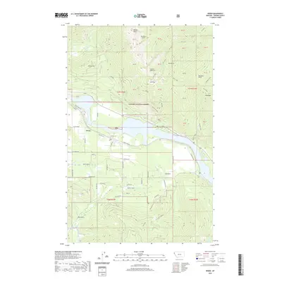
2020 Map of Heron
USGS Topo · Published 2020About this map
Heron sits along the northern banks of the Cabinet Gorge Reservoir, a primary feature of this landscape within the Kaniksu National Forest. The community's local history is anchored by the Heron Cem and a post office simply labeled Po, situated near the confluence of Elk Cr and the reservoir. The surrounding terrain is defined by dramatic elevation changes, from the prominent Billiard Table and Star Peak in the north to the Cabinet Mountains and Pilik Ridge that dominate the eastern portion of the survey.
Find a feature on this map
49 named features on this map. Tap any name to fly to it.
Don’t see what you’re looking for? This feature index may not catch every label — zoom into the map to look around manually.
Map Details
Editions of this 2020 Heron Map
This is the sole edition of this map. No revisions or reprints were ever made.
Other maps of this area

1909 · Cataldo
USGS Topo · 1:125,000

1911 · Cataldo
USGS Topo · 1:125,000

1911 · Priest Lake
USGS Topo · 1:250,000

1913 · Priest Lake
USGS Topo · 1:250,000

1920 · Libby
USGS Topo · 1:125,000

1930 · Libby
USGS Topo · 1:125,000

1932 · Libby
USGS Topo · 1:125,000

1932 · Trout Creek
USGS Topo · 1:125,000

1935 · Trout Creek
USGS Topo · 1:125,000

1936 · Trout Creek
USGS Topo · 1:125,000