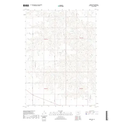
2017 Map of Herrick NW
USGS Topo · Published 2017About this map
Gregory County's agricultural uplands near the Milk's Camp Segment are defined by a network of drainage systems feeding into the S Fork Whetstone Cr. The landscape is etched by the meandering paths of Coon Cr and Petes Cr, which carve through the terrain as it shifts between township boundaries like t97n r71w and t96n r70w. This area is characterized by a high-density grid of rural section roads, indicating a deeply settled farming and ranching community that has maintained its structural layout for generations.
Find a feature on this map
27 named features on this map. Tap any name to fly to it.
Don’t see what you’re looking for? This feature index may not catch every label — zoom into the map to look around manually.
Map Details
Editions of this 2017 Herrick NW Map
This is the sole edition of this map. No revisions or reprints were ever made.
Other maps of this area

1955 · Mitchell
USGS Topo · 1:250,000

1959 · Mitchell
USGS Topo · 1:250,000

1964 · Gregory SE
USGS Topo · 1:24,000

1964 · Herrick NW
USGS Topo · 1:24,000

1964 · Herrick NE
USGS Topo · 1:24,000

1964 · St. Charles
USGS Topo · 1:24,000
1964 · Herrick
USGS Topo · 1:24,000
1964 · Burke
USGS Topo · 1:24,000

1971 · Lucas
USGS Topo · 1:24,000

1971 · Dixon SE
USGS Topo · 1:24,000