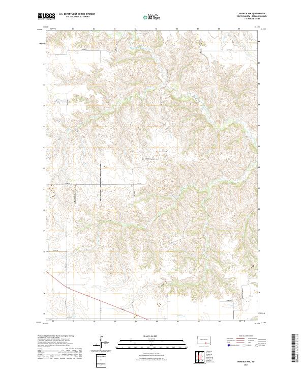
2021 Map of Herrick NW
USGS Topo · Published 2021About this map
South Dakota's Gregory County ranchlands and rolling watersheds are documented here, defined by the intricate drainages of the S Fork Whetstone Cr and its tributaries. The landscape is structured by a rigorous grid of section lines and rural routes, such as Turkey Ridge Rd and the evocatively named Turkey Vulcher Rd. Water is the primary sculptor of this terrain, with Coon Cr and Petes Cr carving deep patterns through the prairie. This 2021 survey by the U.S. Geological Survey provides a detailed view of the contemporary land use in the Nebraska borderlands, where family-named roads like Frey Rd and Hawk Rd signify the enduring agricultural heritage of the region. The map captures the quiet intersection of modern infrastructure, such as Dakota Ln, and the ancient natural pathways carved by Willow Cr.
Find a feature on this map
28 named features on this map. Tap any name to fly to it.
Don’t see what you’re looking for? This feature index may not catch every label — zoom into the map to look around manually.
Map Details
Editions of this 2021 Herrick NW Map
This is the sole edition of this map. No revisions or reprints were ever made.
Other maps of this area

1955 · Mitchell
USGS Topo · 1:250,000

1959 · Mitchell
USGS Topo · 1:250,000

1964 · Gregory SE
USGS Topo · 1:24,000

1964 · Herrick NW
USGS Topo · 1:24,000

1964 · Herrick NE
USGS Topo · 1:24,000

1964 · St. Charles
USGS Topo · 1:24,000
1964 · Herrick
USGS Topo · 1:24,000
1964 · Burke
USGS Topo · 1:24,000

1971 · Lucas
USGS Topo · 1:24,000

1971 · Dixon SE
USGS Topo · 1:24,000