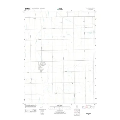
2012 Map of Herscher
USGS Topo · Published 2012About this map
Herscher serves as the primary hub of this agricultural landscape, where a grid of rural roads connects several small settlements and historic burial grounds. The village layout is well-defined by local streets like N Main St and Kay St, reflecting a community centered on the surrounding prairie. Evidence of the area's pioneer heritage is visible in the numerous cemeteries scattered across the countryside, including Grand Prairie United Cem and Saint Peter and Paul Cem. The drainage pattern, defined by waterways such as E Br Horse Cr and Lehigh Raymond Run, has long influenced the development of small hamlets like Goodrich and Lehigh. Genealogists will find this 2012 record valuable for locating family plots at Zion Lutheran Cem or Trinity Cem and exploring the proximity of the Dickeys and Pilot Hill areas.
Find a feature on this map
54 named features on this map. Tap any name to fly to it.
Don’t see what you’re looking for? This feature index may not catch every label — zoom into the map to look around manually.
Map Details
Editions of this 2012 Herscher Map
This is the sole edition of this map. No revisions or reprints were ever made.
Other maps of this area

1922 · Kankakee
USGS Topo · 1:62,500

1923 · Herscher
USGS Topo · 1:62,500

1924 · Kankakee
USGS Topo · 1:62,500

1925 · Herscher
USGS Topo · 1:62,500

1944 · Piper City
USGS Topo · 1:48,000

1944 · Gilman
USGS Topo · 1:62,500

1946 · Gilman
USGS Topo · 1:62,500

1947 · Piper City
USGS Topo · 1:62,500

1953 · Chicago
USGS Topo · 1:250,000

1953 · Danville
USGS Topo · 1:250,000