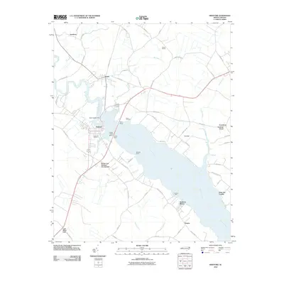
2010 Map of Hertford
USGS Topo · Published 2010About this map
The Perquimans River dominates this coastal North Carolina landscape, widening significantly as it flows past the town of Hertford. This survey captures the region as residential expansion began to shape the traditional waterfront, notably at the Wynne Fork Housing Development and the lakeside community of Southern Shores. The geography is defined by a series of prominent points reaching into the water, including Ferry Point, Barrow Point, and Crow Point Island. Genealogists and local historians can locate long-standing landmarks such as Cedarwood Cemetery and Nixon Cemetery, as well as established surrounding settlements like Winfall, Smithtown, and Burgess. The map also illustrates the transition from rural agricultural land to localized aviation use at Dillard Airport and recreational access at Hertford Beach.
Find a feature on this map
58 named features on this map. Tap any name to fly to it.
Don’t see what you’re looking for? This feature index may not catch every label — zoom into the map to look around manually.
Map Details
Editions of this 2010 Hertford Map
This is the sole edition of this map. No revisions or reprints were ever made.
Other maps of this area

1904 · Edenton
USGS Topo · 1:62,500

1906 · Hertford
USGS Topo · 1:62,500

1906 · Beckford
USGS Topo · 1:48,000

1907 · Beckford
USGS Topo · 1:62,500

1940 · Hertford
USGS Topo · 1:62,500

1940 · Beckford
USGS Topo · 1:62,500

1940 · South Mills
USGS Topo · 1:62,500

1942 · Edenton
USGS Topo · 1:62,500

1943 · Edenton
USGS Topo · 1:62,500

1952 · South Mills
USGS Topo · 1:62,500