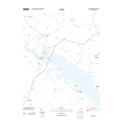
2013 Map of Hertford
USGS Topo · Published 2013About this map
Hertford and Winfall anchor this study of the Albemarle Sound region, where the broad reach of the Perquimans River dominates the landscape. The geography is defined by numerous points and landings, such as Bear Garden Point, Ferry Point, and White Hat Landing, which reflect a long history of water-based transit and commerce. Inland, the map reveals a transition into swampy lowlands, most notably Bagley Swamp to the northwest and several tributary creeks like Yeopim Cr and Sutton Cr that feed into the main river channel.
Find a feature on this map
105 named features on this map. Tap any name to fly to it.
Don’t see what you’re looking for? This feature index may not catch every label — zoom into the map to look around manually.
Map Details
Editions of this 2013 Hertford Map
This is the sole edition of this map. No revisions or reprints were ever made.
Other maps of this area

1904 · Edenton
USGS Topo · 1:62,500

1906 · Hertford
USGS Topo · 1:62,500

1906 · Beckford
USGS Topo · 1:48,000

1907 · Beckford
USGS Topo · 1:62,500

1940 · Hertford
USGS Topo · 1:62,500

1940 · Beckford
USGS Topo · 1:62,500

1940 · South Mills
USGS Topo · 1:62,500

1942 · Edenton
USGS Topo · 1:62,500

1943 · Edenton
USGS Topo · 1:62,500

1952 · South Mills
USGS Topo · 1:62,500