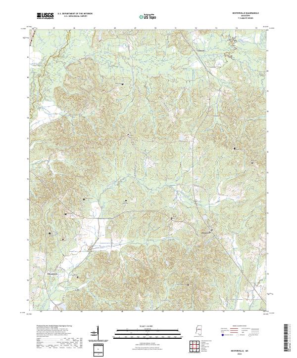
2024 Map of Hesterville
USGS Topo · Published 2024About this map
Hesterville and Possumneck are the central hubs of this rural community on the border of Carroll and Attala counties. The landscape is defined by the winding course of the Big Black River and its numerous tributaries, including Zilpha Creek, Sharkey Creek, and Little Sharkey Creek. These waterways dictate the local topography, with roads like Hesterville Rd and Rocky Point Rd weaving through the hills to connect family-named landmarks and small settlements.
Find a feature on this map
70 named features on this map. Tap any name to fly to it.
Don’t see what you’re looking for? This feature index may not catch every label — zoom into the map to look around manually.
Map Details
Editions of this 2024 Hesterville Map
This is the sole edition of this map. No revisions or reprints were ever made.
Other maps of this area

1953 · West Point
USGS Topo · 1:250,000

1958 · West Point
USGS Topo · 1:250,000

1963 · West Point
USGS Topo · 1:250,000

1964 · West
USGS Topo · 1:24,000

1964 · Kosciusko NE
USGS Topo · 1:24,000

1964 · Hesterville
USGS Topo · 1:24,000
1964 · Durant
USGS Topo · 1:24,000

1964 · Kosciusko
USGS Topo · 1:24,000
1964 · McAdams
USGS Topo · 1:24,000

1966 · Poplar Creek
USGS Topo · 1:24,000