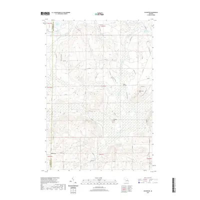
2019 Map of Hetherton
USGS Topo · Published 2019About this map
The Otsego and Montmorency county line bisects this northern Michigan landscape, where the Black River and its East Branch carve through a terrain defined by glacial lakes and wetlands. The settlement of Hetherton sits at the junction of Roby Rd and Co Rd 620, serving as a landmark for genealogists tracing families associated with the nearby Gingell Cem. The map reveals a transition from the water-rich lowlands of the Green Swamp to the elevated prominences of Old Baldy Hill and the Rattlesnake Hills.
Find a feature on this map
52 named features on this map. Tap any name to fly to it.
Don’t see what you’re looking for? This feature index may not catch every label — zoom into the map to look around manually.
Map Details
Editions of this 2019 Hetherton Map
This is the sole edition of this map. No revisions or reprints were ever made.
Other maps of this area

1949 · Lewiston
USGS Topo · 1:62,500

1950 · Lewiston
USGS Topo · 1:24,000

1950 · Johannesburg
USGS Topo · 1:24,000

1951 · Johannesburg
USGS Topo · 1:24,000

1951 · Lewiston
USGS Topo · 1:24,000

1954 · Hetherton
USGS Topo · 1:62,500

1954 · Traverse City
USGS Topo · 1:250,000

1955 · Atlanta
USGS Topo · 1:62,500

1955 · Comins
USGS Topo · 1:62,500

1955 · Cheboygan
USGS Topo · 1:250,000