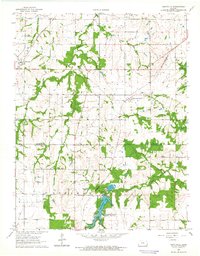
1964 Map of Hiattville
USGS Topo · Published 1965About this map
The boundary between Bourbon and Crawford counties defines the southern half of this landscape, where the prairie begins to break into the drainage basins of Dry Wood Creek and Pawnee Creek. In the mid-1960s, the rural community of Hiattville served as a local hub along the Missouri-Kansas-Texas railroad line. Further east, Pawnee Station sits near the headwaters of Richland Creek, illustrating the importance of rail access for these agricultural townships.
Find a feature on this map
20 named features on this map. Tap any name to fly to it.
Don’t see what you’re looking for? This feature index may not catch every label — zoom into the map to look around manually.
Map Details
Editions of this 1964 Hiattville Map
This is the sole edition of this map. No revisions or reprints were ever made.
Other maps of this area

1884 · Fort Scott
USGS Topo · 1:125,000

1886 · Fort Scott
USGS Topo · 1:125,000

1893 · Fort Scott
USGS Topo · 1:125,000

1947 · Joplin
USGS Topo · 1:250,000

1948 · Mulberry
USGS Topo · 1:62,500

1948 · Girard
USGS Topo · 1:62,500
1949 · Girard
USGS Topo · 1:62,500

1949 · Joplin
USGS Topo · 1:250,000
1950 · Mulberry
USGS Topo · 1:62,500

1954 · Joplin
USGS Topo · 1:250,000