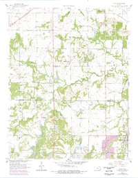
1959 Map of Cato
USGS Topo · Published 1978About this map
Dry Wood Strip Mines dominate this Kansas landscape along the Bourbon Co Crawford Co line, revealing a terrain heavily shaped by surface mining. Extensive strip mines and tailings surround the settlements of Cato, Arcadia, and Garland, following the coal-bearing seams of the region. The industrial footprint is juxtaposed with numerous rural landmarks, including the Bible Tabernacle, Cherry Grove Ch, and schools like Star Sch and Gish Sch.
Find a feature on this map
37 named features on this map. Tap any name to fly to it.
Don’t see what you’re looking for? This feature index may not catch every label — zoom into the map to look around manually.
Map Details
Editions of this 1959 Cato Map
2 editions found
Other maps of this area

1884 · Fort Scott
USGS Topo · 1:125,000

1886 · Fort Scott
USGS Topo · 1:125,000

1893 · Fort Scott
USGS Topo · 1:125,000

1939 · Deerfield
USGS Topo · 1:24,000

1942 · Deerfield
USGS Topo · 1:24,000

1947 · Joplin
USGS Topo · 1:250,000

1948 · Mulberry
USGS Topo · 1:62,500
1948 · Liberal
USGS Topo · 1:24,000

1948 · Girard
USGS Topo · 1:62,500
1948 · Garland
USGS Topo · 1:24,000