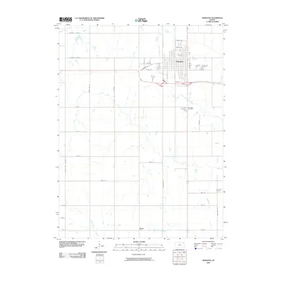
2009 Map of Hiawatha
USGS Topo · Published 2009About this map
The town of Hiawatha anchors this Brown County landscape, positioned at a regional crossroads where the agricultural grid meets a network of vital waterways. As of 2009, the town's organized street plan, including Oregon St and Iowa St, extends toward the Mount Hope Cemetery and the Hiawatha City Dam. Outside the main settlement, the rural character is defined by the winding paths of the Wolf River and its tributaries, such as the North Fork Wolf River and Middle Fork Wolf River.
Find a feature on this map
37 named features on this map. Tap any name to fly to it.
Don’t see what you’re looking for? This feature index may not catch every label — zoom into the map to look around manually.
Map Details
Editions of this 2009 Hiawatha Map
This is the sole edition of this map. No revisions or reprints were ever made.
Other maps of this area

1885 · Atchison
USGS Topo · 1:125,000

1888 · Atchison
USGS Topo · 1:125,000

1888 · Hiawatha
USGS Topo · 1:125,000

1893 · Atchison
USGS Topo · 1:125,000

1894 · Hiawatha
USGS Topo · 1:125,000

1950 · Kansas City
USGS Topo · 1:250,000

1954 · Kansas City
USGS Topo · 1:250,000

1956 · Kansas City
USGS Topo · 1:250,000
1959 · Morrill
USGS Topo · 1:24,000

1960 · Kansas City
USGS Topo · 1:250,000