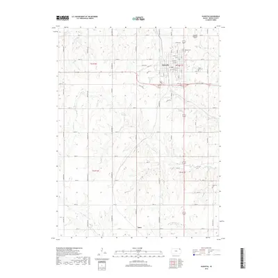
2018 Map of Hiawatha
USGS Topo · Published 2018About this map
Hiawatha serves as the primary hub of this Brown County landscape, defined by a rigid grid of rural section roads and the winding path of the Wolf River. The town's street plan honors tribal heritage with names like Kickapoo St, Pottawatomie St, and Shawnee St, reflecting the area's deep history. To the south, the small settlement of Baker sits near the Middle Fork Wolf River, while the northern outskirts are home to the Hiawatha Municipal Airport.
Find a feature on this map
52 named features on this map. Tap any name to fly to it.
Don’t see what you’re looking for? This feature index may not catch every label — zoom into the map to look around manually.
Map Details
Editions of this 2018 Hiawatha Map
This is the sole edition of this map. No revisions or reprints were ever made.
Other maps of this area

1885 · Atchison
USGS Topo · 1:125,000

1888 · Atchison
USGS Topo · 1:125,000

1888 · Hiawatha
USGS Topo · 1:125,000

1893 · Atchison
USGS Topo · 1:125,000

1894 · Hiawatha
USGS Topo · 1:125,000

1950 · Kansas City
USGS Topo · 1:250,000

1954 · Kansas City
USGS Topo · 1:250,000

1956 · Kansas City
USGS Topo · 1:250,000
1959 · Morrill
USGS Topo · 1:24,000

1960 · Kansas City
USGS Topo · 1:250,000