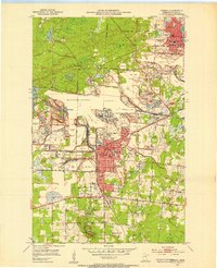
1951 Map of Hibbing
USGS Topo · Published 1953About this map
The Mahoning-Hull-Rust Mine dominates this 1950s landscape, illustrating the massive scale of iron extraction on the Mesabi Range. This survey captures the complex spatial relationship between the expanding open-pit mines and the urban centers of Hibbing and Chisholm. The map reveals the encroaching industrial footprint, with vast Mine Dumps and tailings ponds surrounding established neighborhoods like North Hibbing and Brooklyn. The Laurentian Divide cuts across the northern section, marking a significant hydrologic boundary amidst the heavy industry. Transportation networks are deeply integrated into the mining economy, featuring the Great Northern and Duluth Missabe and Iron Range railroads. Beyond the pits, local community life is visible in the numerous schools such as Alice Sch and Cobb-Cook Sch, and the presence of the Mesaba Country Club and Chisholm State Game Refuge.
Find a feature on this map
56 named features on this map. Tap any name to fly to it.
Don’t see what you’re looking for? This feature index may not catch every label — zoom into the map to look around manually.
Map Details
Editions of this 1951 Hibbing Map
2 editions found
Other maps of this area

1951 · Hibbing
USGS Topo · 1:24,000

1951 · Buhl
USGS Topo · 1:24,000

1952 · Keewatin
USGS Topo · 1:24,000

1952 · Riley
USGS Topo · 1:24,000

1952 · Silica
USGS Topo · 1:24,000

1952 · Little Swan
USGS Topo · 1:24,000

1954 · Hibbing
USGS Topo · 1:250,000

1955 · Dewey Lake SE
USGS Topo · 1:24,000

1955 · Dewey Lake
USGS Topo · 1:24,000

1957 · Hibbing
USGS Topo · 1:250,000