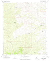
1967 Map of Hibernia Peak
USGS Topo · Published 1974About this map
Hualapai Mountains define this high-elevation landscape, where the prominent Hibernia Peak and Orejano Peak overlook a complex network of seasonal drainage channels and steep ravines. In the mid-1960s, this area remained largely undeveloped, characterized by numerous dry washes including Blue Tank Wash, Left Hand Moss Wash, and the winding Bull Canyon. The presence of a Mine and various prospects suggests the enduring legacy of mineral exploration in these mountains, which was supported by a network of jeep trails cutting through the difficult terrain.
Find a feature on this map
17 named features on this map. Tap any name to fly to it.
Don’t see what you’re looking for? This feature index may not catch every label — zoom into the map to look around manually.
Map Details
Editions of this 1967 Hibernia Peak Map
3 editions found
Other maps of this area

1886 · Diamond Creek
USGS Topo · 1:250,000

1892 · Diamond Creek
USGS Topo · 1:250,000

1923 · Signal
USGS Topo · 1:250,000

1942 · Signal
USGS Topo · 1:250,000

1948 · Williams
USGS Topo · 1:250,000

1950 · Prescott
USGS Topo · 1:250,000

1954 · Prescott
USGS Topo · 1:250,000

1954 · Williams
USGS Topo · 1:250,000

1956 · Williams
USGS Topo · 1:250,000

1958 · Prescott
USGS Topo · 1:250,000