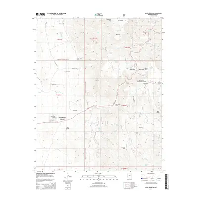
2014 Map of Hickey Mountain
USGS Topo · Published 2014About this map
Prescott Valley and the surrounding high-elevation terrain of the Black Hills are documented here, capturing a landscape where suburban expansion meets protected wilderness. The residential developments of the valley, characterized by streets like E Wildcat Way and Legend Hills Rd, contrast sharply with the steep, rugged slopes of Hickey Mountain and Mingus Mtn. This area has long served as a vital water source and industrial site, evidenced by the numerous tanks and springs such as Rick Tank and Red Seep Spring, alongside the Yaeger Mine. The map highlights the significant presence of the Prescott National Forest, which blankets much of the high ground, protecting features like Woodchute Mtn and Kendall Peak. This topography dictates the path of State Hwy 89A as it winds through Yaeger Canyon, providing a critical transit link between the valley floor and the canyons to the east.
Find a feature on this map
77 named features on this map. Tap any name to fly to it.
Don’t see what you’re looking for? This feature index may not catch every label — zoom into the map to look around manually.
Map Details
Editions of this 2014 Hickey Mountain Map
This is the sole edition of this map. No revisions or reprints were ever made.
Other maps of this area

1887 · Prescott
USGS Topo · 1:250,000

1892 · Prescott
USGS Topo · 1:250,000

1905 · Jerome
USGS Topo · 1:125,000

1944 · Clarkdale
USGS Topo · 1:48,000

1944 · Mingus Mountain
USGS Topo · 1:62,500

1947 · Mingus Mtn
USGS Topo · 1:62,500

1947 · Paulden
USGS Topo · 1:62,500

1947 · Prescott
USGS Topo · 1:62,500

1948 · Prescott
USGS Topo · 1:62,500
1948 · Clarkdale
USGS Topo · 1:62,500