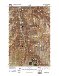
2011 Map of Hickland Butte
USGS Topo · Published 2011About this map
Hickland Butte dominates the northern skyline of this high desert terrain in Gilliam County, where the landscape is defined by deep drainages and isolated landmarks. The region’s early ranching and homesteading roots are preserved in the locations of Eightmile Cemetery and the Tommy Dean Cemetery, which stand as quiet markers of the families who settled this arid plateau. Modern connectivity is maintained through a network of rural routes such as Fairview Rd and Cecil Rd, which navigate the elevation changes near Eightmile Canyon and Cow Canyon. These geographic features suggest a land shaped by seasonal water flow and livestock movement, typical of the eastern Oregon wheat and cattle country. The proximity of Mason Rd and Davidson Rd further delineates the structured land divisions of this agricultural interior.
Find a feature on this map
11 named features on this map. Tap any name to fly to it.
Don’t see what you’re looking for? This feature index may not catch every label — zoom into the map to look around manually.
Map Details
Editions of this 2011 Hickland Butte Map
This is the sole edition of this map. No revisions or reprints were ever made.
Other maps of this area

1906 · Blalock Island
USGS Topo · 1:125,000

1908 · Blalock Island
USGS Topo · 1:125,000

1916 · Arlington
USGS Topo · 1:125,000

1916 · Condon
USGS Topo · 1:125,000

1953 · Pendleton
USGS Topo · 1:250,000

1953 · The Dalles
USGS Topo · 1:250,000

1956 · The Dalles
USGS Topo · 1:250,000

1956 · Pendleton
USGS Topo · 1:250,000

1957 · The Dalles
USGS Topo · 1:250,000

1964 · Shutler Flat
USGS Topo · 1:24,000